


NW013 Voting District, St. Louis County, Missouri
About
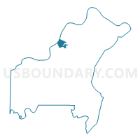
Outline

Summary
| Unique Area Identifier | 610962 |
| Name | NW013 Voting District |
| County | St. Louis County |
| State | Missouri |
| Area (square miles) | 3.15 |
| Land Area (square miles) | 3.00 |
| Water Area (square miles) | 0.15 |
| % of Land Area | 95.29 |
| % of Water Area | 4.71 |
| Latitude of the Internal Point | 38.75031510 |
| Longtitude of the Internal Point | -90.47764420 |
Maps


Graphs
Select a template below for downloading or customizing gragh for NW013 Voting District, St. Louis County, Missouri


Neighbors
Neighoring Voting District (by Name) Neighboring Voting District on the Map
- 014-Lincoln Voting District, St. Charles County, MO
- 016-Montclair Voting District, St. Charles County, MO
- 071-Fairways Voting District, St. Charles County, MO
- MHT015 Voting District, St. Louis County, MO
- NW019 Voting District, St. Louis County, MO
- NW021 Voting District, St. Louis County, MO
- NW032 Voting District, St. Louis County, MO
- NW033 Voting District, St. Louis County, MO
- NW035 Voting District, St. Louis County, MO
- NW036 Voting District, St. Louis County, MO
- NW038 Voting District, St. Louis County, MO
- NW206 Voting District, St. Louis County, MO
- NW210 Voting District, St. Louis County, MO
- NW220 Voting District, St. Louis County, MO
Top 10 Neighboring County Subdivision (by Population) Neighboring County Subdivision on the Map
- Maryland Heights township, St. Louis County, MO (36,370)
- Northwest township, St. Louis County, MO (32,245)
- Frontier township, St. Charles County, MO (26,850)
- Rivers township, St. Charles County, MO (22,257)
Top 10 Neighboring Place (by Population) Neighboring Place on the Map
- St. Charles city, MO (65,794)
- Maryland Heights city, MO (27,472)
- Bridgeton city, MO (11,550)
- Champ village, MO (13)
Top 10 Neighboring Unified School District (by Population) Neighboring Unified School District on the Map
- Francis Howell School District, MO (113,553)
- St. Charles R-VI School District, MO (53,421)
- Pattonville School District, MO (41,088)
Top 10 Neighboring State Legislative District Lower Chamber (by Population) Neighboring State Legislative District Lower Chamber on the Map
- State House District 15, MO (40,041)
- State House District 79, MO (34,555)
- State House District 18, MO (32,967)
- State House District 78, MO (30,572)
Top 10 Neighboring State Legislative District Upper Chamber (by Population) Neighboring State Legislative District Upper Chamber on the Map
- State Senate District 23, MO (170,166)
- State Senate District 24, MO (166,007)
- State Senate District 7, MO (160,542)
Top 10 Neighboring 111th Congressional District (by Population) Neighboring 111th Congressional District on the Map
Top 10 Neighboring Census Tract (by Population) Neighboring Census Tract on the Map
- Census Tract 2132.02, St. Louis County, MO (6,811)
- Census Tract 2151.44, St. Louis County, MO (5,727)
- Census Tract 2132.03, St. Louis County, MO (4,759)
- Census Tract 3110.01, St. Charles County, MO (4,049)
- Census Tract 3110.03, St. Charles County, MO (3,207)
- Census Tract 2151.43, St. Louis County, MO (2,975)
- Census Tract 3105.02, St. Charles County, MO (2,865)
- Census Tract 2131.02, St. Louis County, MO (411)